Underground, out of sight and out of mind – that’s often how we treat the complex web of pipes, cables, conduits, and other infrastructure crisscrossing beneath our feet.
We expect power, water, gas and all the other essentials these assets provide to just be there at the flick of a switch. But have you ever thought about what it takes to install, locate and maintain these buried backbone networks we rely on?
It’s a messy business trying to map out all that unseen infrastructure, especially in built-up urban areas where new developments constantly cover up existing assets. Yet without accurate location and mapping data, we open ourselves up to a whole heap of safety issues, potential service outages, and blown budgets when we accidentally dig into something!
Believe it or not, there’s still no complete map showing exactly where all those buried electricity cables, internet fibres, sewer mains, and gas lines are hiding. And if the asset owners themselves don’t have reliable subsurface utility engineering detail, how are they supposed to manage inspection, maintenance and prompt emergency repairs when needed? Let me tell you, in my city alone we’ve had water main floods, electrical fires and sinkholes erupt due to poor knowledge of what’s happening underneath the footpaths.
So unless you want excavators to keep playing a risky game of underground roulette whenever they sink a shovel into the earth, it’s high time we started paying more attention to the web of infrastructure buried below. The technology now exists to accurately survey and map assets without having to fully dig them up. And doing so delivers a heap of public safety, planning and even cost saving benefits. Read on as we uncover the growing discipline of underground utility mapping.
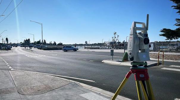
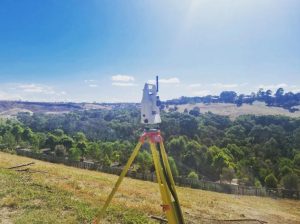
When it comes to figuring out what’s happening underneath our feet, utility mappers and engineers have a neat box of tricks to peek into the subsurface without needing full excavations. Let’s unpack some of their craftiest asset locating equipment and approaches.
We’ll start with electromagnetic pipe and cable locators – these handy devices can send signals along buried metal and even non-conducting utilities. The units detect distortions in the electromagnetic field which reveals the orientation and rough depth of whatever that pipe or fibre is doing underground. Just don’t expect it to actually tell you what type of utility has been found!
Next up, ground penetrating radar (GPR) is great for seeing even deeper without digging. By rolling a specialist radar unit aboveground, radio waves bounce back any objects they hit. This creates reflections in the signal data which can clearly highlight non-metallic utilities like plastic piping. The catch is that surrounding soil conditions can hamper how deep GPR can actually penetrate.
If you need to literally see what structure has been mapped underground, vacuum excavation trucks are an increasingly popular way for project managers to validate assets. These babies use pressurised air and industrial vacuum units to safely expose utilities for visual checks and laser surveys. Just be prepared for an expensive time suck if entire long pipelines require validation!
Of course, once buried infrastructure has been located, the next step is appropriately capturing and recording what the heck is down there. Modern mapping techniques allow extremely accurate GPS positioning of underground assets with supplementary depth measurements. Importantly, captured utility data also details vital size, material and grading attributes needed for safety management and maintenance.
With accurate 3D mapping of underground utilities in hand, the real game-changing applications can begin for cities and infrastructure owners. Just take the major safety risks that are mitigated when the buried unknowns start becoming known.
By integrating detailed subsurface utility engineering (SUE) data into contract tendering and construction plans, underground safety hazards can be flagged well before projects break ground. Construction teams are empowered to precisely mark out known utility zones for avoidance via practices like potholing visual checks along the dig site. Even better, comprehensive utility mapping allows project managers to model virtual excavations and detect clashes with existing assets early in design phases.
Talking from experience here, not knowing what lies beneath has caused countless incidents from gas line ruptures to power cable stripping over the years during my city’s building boom. Billions go towards emergency repairs which could have easily been prevented if due underground diligence was done beforehand!
The safety and risk planning advantages don’t stop once projects are complete either. By feeding as-built utility data into city-wide information management systems, obstruction risks can also be controlled during future maintenance and repair programs. Having carefully mapped the key gas, electricity, communications, sewage and drainage assets means their existence, age and criticality is no longer mysterious.
With reliable subsurface detail, issues like leakage or line breakages can be addressed rapidly through shutdowns and rerouting. Outage impacts are minimised for surrounding homes and businesses as repair crews know exactly where to isolate and fix the damage. Try getting that resolution chasing phantom pipes the old fashioned way!
While it’s not the most glamorous field, subsurface utility engineering is fast becoming an unsung hero keeping our urban foundation functioning safely. The aboveground innovations of smart cities also need to be firmly grounded upon knowing what assets sustain us from beneath. Hopefully the amazing potential of underground infrastructure mapping is now clearer to you, even with all the dirt and mysteries it aims to dig up!
After unearthing the importance of buried utility mapping, where can this growing field progress next for even safer and smarter cityscapes?
Exciting innovations on the horizon include robotics and drones tailored to automate subsurface surveys. Small drones with ground penetrating gear can soon crawl through pipelines to evaluate asset integrity from the inside out. While aboveground, drones wielding array sensors are poised to rapidly map utilities without disruptive digging. Technologies like AI pattern matching will help highway agencies automatically classify buried structures detected and assess deterioration risks.
Of course, even foolproof subsurface mapping tools need usable data interfaces on the human side. We must break free of the days when crucial infrastructure knowledge got fragmented across disconnected spreadsheets or filing cabinets. Instead, centralised geospatial platforms, like North America’s SUE initiative, allow consolidated 3D mapping visualisations for entire regions. By merging legacy records with modern scanning techniques, burying troublesome utility blindness should become a thing of the past.
So while subsurface utilities remain out of sight, comprehensive mapping and data access initiatives are making sure they don’t languish out of mind. Safer communities plus smarter planning require us to keep pushing the boundaries of what’s happening six feet under. Because only by truly exposing buried secrets can we protect those vital assets destined to see the light of day.